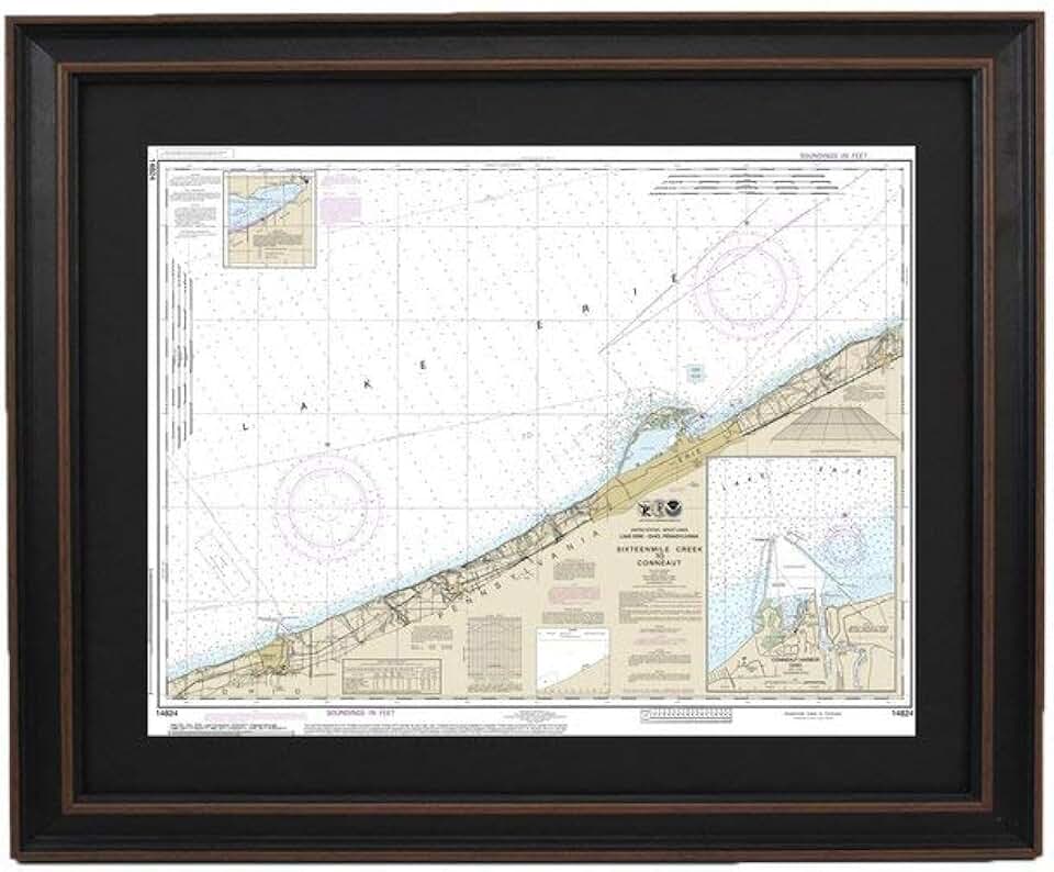
The Framed Nautical Map 14824 offers a truly unique blend of artistry, history, and geographical detail, bringing a specific stretch of Lake Erie right into your living space. This particular piece meticulously depicts the area from SixteenMile Creek to Conneaut, including Conneaut Harbor, presented in a striking poster size and handcrafted in the USA.
For enthusiasts of maritime history, avid boaters, or those simply seeking distinctive decor, this map provides a profound connection to the Great Lakes. It serves not just as a decorative item but also as a conversation starter, inviting exploration of its intricate details and the stories embedded within its charted waters.
Quick Summary
Rating: 4.8/5 (Based on product quality and type)
Price: $324.99 USD
Key Pros:
- Authentic and highly detailed nautical chart data.
- Premium framing and high-quality print for lasting appeal.
- Handmade in USA, ensuring superior craftsmanship and attention to detail.
- Exceptional decorative piece for nautical themes or local pride.
Key Cons:
- Higher price point due to framing and bespoke nature.
- Geographically specific, limiting its appeal to a niche audience.
Table of Contents
Framed Nautical Map 14824 Overview
The Framed Nautical Map 14824 is much more than a simple wall decoration; it is a meticulously crafted representation of a vital stretch of Lake Erie. Nautical maps, historically, have been indispensable tools for mariners, guiding them through treacherous waters and charting safe passages. This particular map transforms that functional utility into a piece of art.
It focuses on the area between SixteenMile Creek and Conneaut, Ohio, extending to include the intricate details of Conneaut Harbor. This region is significant for its maritime history, commercial shipping, and recreational boating, making the map particularly resonant for those familiar with or interested in the Great Lakes.
The